Satya's blog - Clingman's Dome
Continuing the account of the North Carolina trip, Sunday April 17, 2005.
After wandering around Cherokee, we eventually drove into the national forest. A helpful park ranger at the Oconaluftee visitor center told us about Clingman's Dome, which is supposed to be some 40 feet below the highest point east of the Mississippi -- presumably west of the east US coast, too. He also told us about some nice trail, but we missed it. The drive through the forest/park is nice -- along the Oconaluftee river (see map). Nice twisty roads. We went up the Blue Ridge Parkway for a few hundred meters, but decided we didn't want to go to Asheville just then. Clingman's Dome parking lot is reached by turning off the park road just before it crosses the Appalachian trail. Another steeper and twistier road goes up to the parking lot, from where it's a hard half-mile 
At the top is a spiral walkway that leads up higher to an observation post. This walkway is a little scary if you are at all afraid of heights, but the view from the top is nice. ("I'm at the top of the world, looking down Clingman's Dome, and I have vertigo.") 
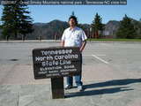
Walked back down, which is also hard because it hurt my shins. Just have to be careful and take it slow. Carrying a stick or hiking staff probably helps. We went to see the famous Appalachian trail at Newfoundland Gap (see map). Apparently it's also the Tennessee/North Carolina border: 
The same park ranger told us about Mingo Falls, which is either 150 or 400 feet -- probably 150. We got a little confused on the way, wandering into KOA campground where the nice people told us it's about 20 minutes up the road. I think they meant 20 minutes on foot, because it was around the next bend. Here, poor out-of-shape me climbed a huge series of steps along the waterfall to the top, where I found a bridge across the falls. Nice setting, nice water. I wandered into the stream a bit: 
And then we headed back to Cherokee. Last updated: Jan 22 2006 13:08 |
|